Editor’s Note: I wrote and published this post in 2014. It has always been one of my favorites and so much of what I have reflected on still resonates with me today. I think it is quite appropriate that for the past six years of working at the NOLS Rocky Mountain that my office has been the map room. And as I venture out beyond that map room, the final paragraph still rings true.
I love maps. Road maps, topographical maps, geological maps, political maps, heck, almost any type of map will garner immediate interest from me. I once moved into a room that had a wall sized map of the world on one wall. I never took it down and instead stood, looking, staring, studying and wondering at it for hours. I love analyzing maps and trying to figure out what the terrain is like or what it represents. Maps are symbols of plans or history, both exciting in their own realm. In part, it is why I wrote a guidebook; I got to use a map, explore, and document what is out there. Then I got to use Google Earth to draw the maps it needed. I like having maps of where I’ve been. Maps are tools for dreamers. I like sitting on tent floors with a bunch of maps spread out before me looking at options of where I am going. Maps represent vision and action. They fill me with courage and fill me with fear. My favorite part of an airline’s inflight magazine is the route/destination maps. The small blue lines showing where flights originate and travel keep me occupied even entranced. It helps me dream. Where can I use my slowly racking up frequent flyer miles to go to next? When I was in my twenties I wanted to travel from Alaska to Tierra el Fuego so I ordered a bunch of maps then studied and planned for months.
Even as a kid, I loved maps. I would bury “time capsules” in the backyard, then draw maps to them. The trail maps that came in the back of the guidebook to the White Mountains were poured over, used and abused. Then I was introduced to the specific Appalachian Trail maps with their elevation profiles and fell in love with that concept. I had to get them all. Not long into high school posters of Roger Clemens and Wade Boggs started being replaced by maps. The free map supplements that came with the National Geographic were always a score. My brother and I used to “collect” brochures when we were younger and for me the ultimate was the state road map.

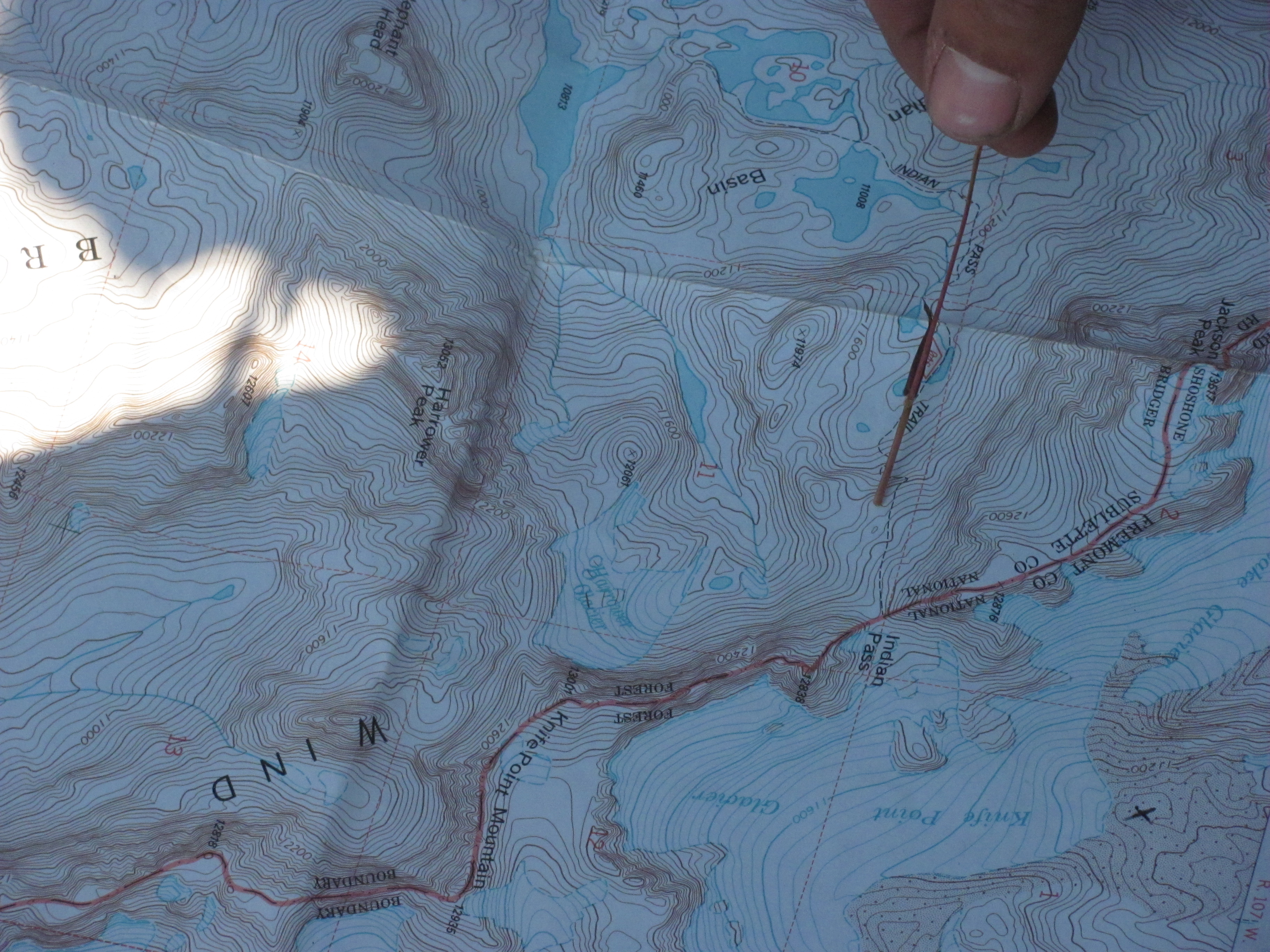
I have two real wall hangings in what I call my home (a storage closet in the Noble Hotel’s room 306) and both are maps. They could not be any more different. One is hand drawn by my then girlfriend Emily, representing in loving detail, places we had been, adventures we had and places we dreamed about going. It is exquisitely drawn and prominently displayed, well, as prominent as something can be in a closet. The other is the USGS Bridger Jack Mesa 7.5 minute quad. Indian Creek. The map was purchased not to explore, but to inspire. I own one other wall hanging that will some day have prominence of display and it is a geological cross section map of Southern Utah from Cedar Breaks to Capitol Reef. Also in the closet, tucked away in a rubbermaid bin, is a folder of maps. All sorts, from everywhere I have been and every where I want to go. It is where my maps of the Americas are and of Baffin Island and of the Fitz Roy Massif and of the Bob Marshall Wilderness. A former housemate, Beth, had the entire collection of USGS quads covering southern Utah’s Boulder Top on her walls. In the room next door I had the 15 minute series of maps that covered all of Wayne County. Leah and I would stand and stare at those walls and concoct epic runs. When we moved out, the collection came with and still they await more use. I love walking into a NOLS base and finding their map collection, off trail guide or course area maps mounted on the wall. It is like walking into a room of endless possibilities.
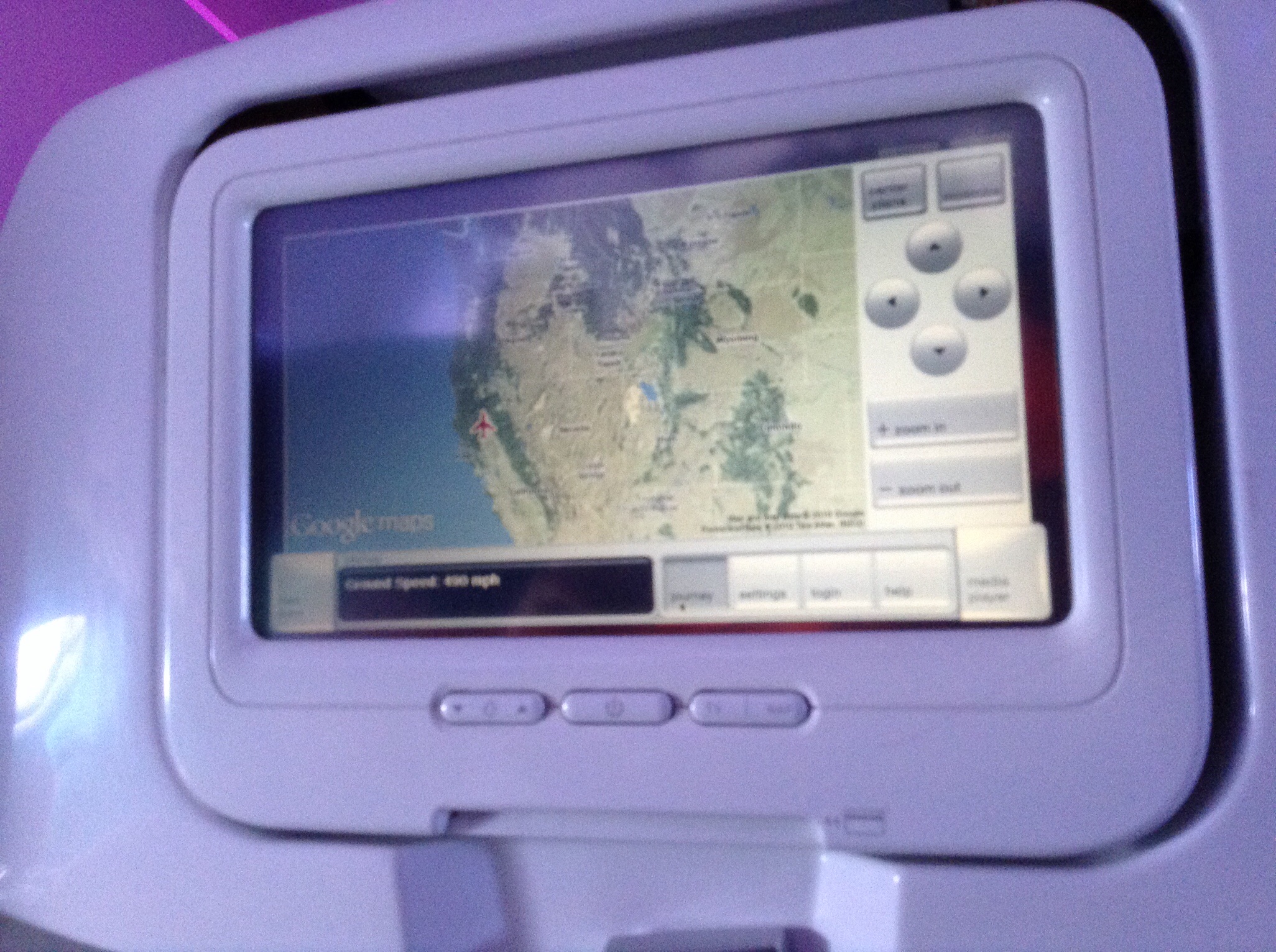
As I write this I am 30’000 feet somewhere above the west coast of the Americas. I pause from typing to squint and look at the Airshow map in front of me. We are off the coast of Mexico, just west of Acapulco. It’s not just the paper maps that draw me in. I could watch that Airshow for a twelve hour flight, seeing the little plane icon move slowly across the screen. What land mass are we over? How fast are we moving? The same with Google Maps or Google Earth. I long to be able to change the little blue dot on Anna’s iPhone’s Google Maps app to purple, to better represent her car. The electronic maps available with a few key strokes and taps of a screen are no less interesting than their paper counterparts. The technological details and inspiration required to make a three dimensional map of the Grand Canyon for Google’s Street View is amazing.
As far as I am concerned maps are only getting better. And as Shakespeare’s Prince Hamlet said, there’s the rub. As far as this earth is concerned, there will never be more blank spaces on a map. Looking outward away from this planet we have started mapping our neighboring planets and out solar system. There are new maps and more knowns, but the more we know the more we know we don’t know. Terrain does not need to be unexplored or unmapped to inspire adventure. Looking at a map and figuring out how I can cover new country or what peak I can climb that I have not summited before entices me. Will this valley go? How about that ridge? These contours come together very closely, will there be good rock for climbing? Should we go have a look around? Maps and unknown territory give me a taste of suspense. Blank and unknown spots on maps scare me, but there are so damn few left that I am drawn to them like a yucca moth to a yucca. Then, when I have returned, tired, smiling and wiser from my journey, I like looking at the map again and knowing that I have rendered it obsolete, knowing that I know the terrain like I know the back of my hand.
Journeys are made so much easier with maps. For the important journey however, there is no road or topographical map. We wander through life forging ahead as days and years go by. Some may leave a map or trail behind, showing others where they have been, but the path ahead is not mapped though many others have gone before. We can strive to follow in another’s footsteps, to recreate what we have seen, but eventually we will all have to enter that blank spot on the map, move into unknown terrain and explore life on our own terms, not those terms of whom we strive to emulate. Similarly we can lay down a smooth, paved path for our loved ones to follow, which they may or may not choose to use or we can walk with them every step of the way to give support as they stumble and soar on a path of their choosing. It is not easy. Maybe that is why I love maps so much; they keep it simple. They tell us what we don’t know. And help me dream.
I love the last paragraph of your entry. You are truly and inspiration!