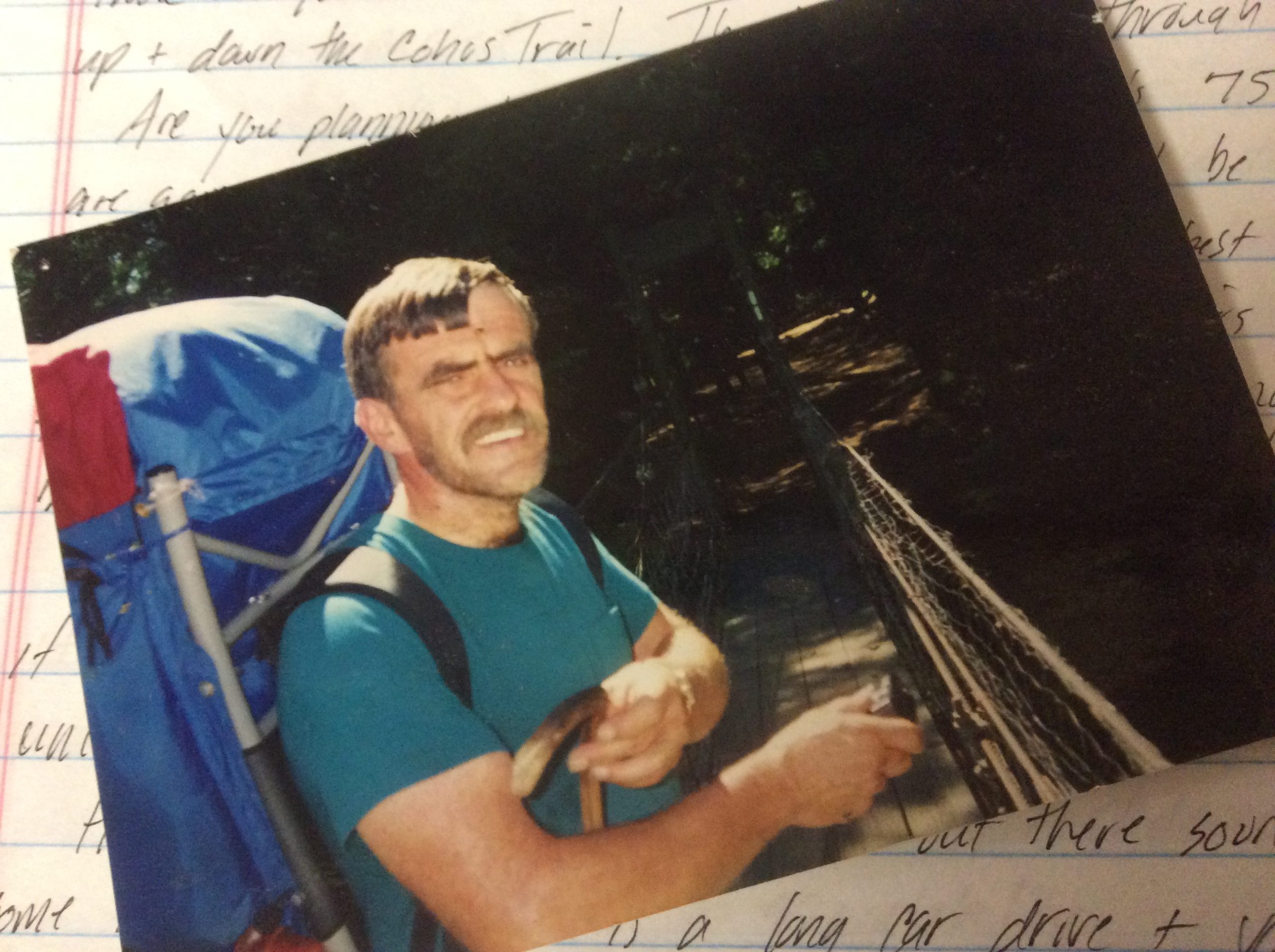
Editor’s Note: On the table by the window here at 616 Washakie sits a sun faded copy of Daniel Doan’s book, Our Last Backpack. It was a gift to my dad back in the early 90’s when we were backpacking a lot together. I took it from the book shelf at my mother’s house in Stark a few years back and have been slowly re-reading it. It prompted me to search through the cobwebs of my mind and old journals to see if I could find where and when my last backpacking trip with my dad took place. As I am now, I was an avid recorder/journaler then too, and had notes from my backpacks and hikes. Although he passed away in the fall of 1996, I can’t seem to find any notes about a summer backpacking trip with him that year, which truthfully, seems a bit odd. If the below reporting was indeed our last backpack, then it was a good one to end on. The version below was published in the local newspaper (with edits of course) as he and I were employed at the printing press stuffing inserts every Tuesday and Friday evenings. Be forewarned, it is very didactic and focuses on filling water bottles/water sources, eating weather, and distances/times walked. It is also filled with random grammatical mistakes.
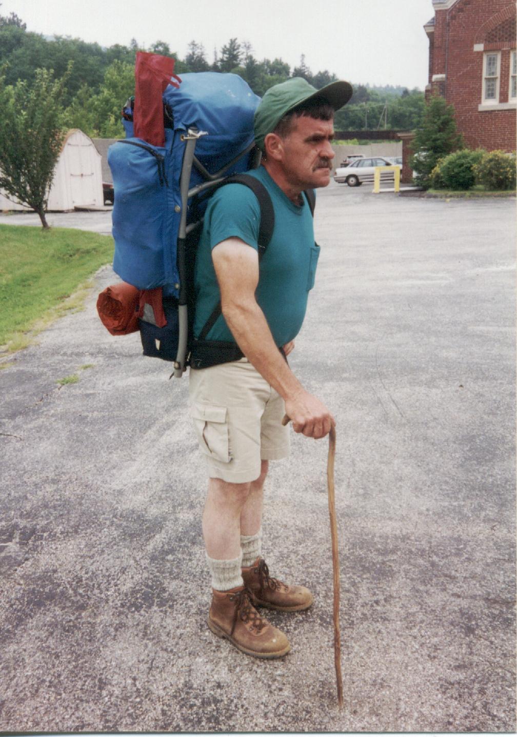
The following are excerpts from my journal I kept when my dad and I hiked from North Adams, Massachusetts to Hanover, New Hampshire on The Appalachian Trail (AT). The AT is a footpath the extends about 2,200 miles from Springer Mt in Georgia to Mt Katahdin in Maine’s Baxter State Park. The thru-hikers mentioned are people who are hiking from Georgia to Maine or vice versa. The length of our trip was only 144 miles and we completed it in eleven days. My pack was 65 lbs when we left and Vic’s was about 55 lbs. The shelters were mostly 3 sided log buildings with a raised sleeping surface (bunk) along with acrobatic mice that always managed to get into our food stuff sacks, even though we hung them from the beams on the ceiling. The shelters usually also had a fire ring and a water source, some of which were a bit dry leaving us a bit thirsty. We used mainly freeze dried food and lemonade along with PBJ and peanut butter and crackers for lunch.
Day 1 Wednesday 8-2-95 The question “why do I do this?” is constantly running through my head. It sure is not for the fun of it. We left from North Adams at 2:10 (a year and a day after we started our hike in Monson, Maine). We hiked up to Seth Warner Shelter and Campsite. We passed over the Vermont/Massachusetts state line, four miles from North Adams, at 4:50 and over a couple of fine lookouts south. We did the remaing 2.8 miles from the state line to the shelter in 1 and 1/4 hours. We set up the tent and I am cooking beef stew for myself. Dad says he is not hungry. There are three thru-hikers at the shelter, two northbounders and a southbounder. The water source really sucks as it is not moving anyware fast and is rather murky. For some reason there is a nagging ache in my back. I don’t know why, must be that 65 lbs pack. Hiked 6.9 miles today.
Day 2 Thursday 8-3-95 They call the AT the Long Green Tunnel. They should call it the Long Greenhouse. It was green, cloudy, humid, and wet. Oh yeah and wet. We got up at 6:00 and I went to get water form the puddle and dad took down the tent. I cooked and burned the eggs we had for breakfast (it takes some practice cooking eggs in a dented aluminum fry pan). We started hiking at 7:55 and reached the County Road at 8:00. We then ascended an unnamed hill and walked in the clouds until we reached Sucker Pond, a small aptly named pond. Took a quick break and contrinued on to Cogndon Camp, a small three sided shelter located among weeds and rasberry bushes, where we ate lunch. I attempted to get water from the stream just south of the camp but my water filter was clogged from the muddy puddle we used last night for water. We ascended Harmon Hill, an old overgrown pasture, of course we were in the clouds, so we could not see a thing. On the way down to Vt Route 9 it started to rain. We stopped and put raincovers on our packs and continued to steeply descend. We reached the highway at 2:30 and decided to hitch a ride into Bennington, Vt. for the night (no I did not wimp out but Victor though he was getting heat stroke). We managed to get a ride without even putting out our thumbs because there was a man in the hikers parking lot who was headed into Bennington and offered us a ride. We stopped at the cheesy, rundown, one night stand type motel, THE HOMESTEADER MOTEL. It had a perculiar odor and a jimmy rigged Air Conditioner, at LEAST the AC worked. I took the opportunity to clean my water filter and watched some TV. We went down to Little Ceasers for supper and had a small pizza. We hiked 11 and 1/2 miles today, and I decided I hike for the personal satisfaction I get from challenging myself to go a little further or push a little harder (even when wet, cold, hungry, and tired).
Day 3 Friday 8-4-95 It is 6:30 pm and I am sitting here thinking about working at the Beacon stuffing papers. Time to get rid of that unpleasent thought. We left the Homesteader at 7:20. we called a cab and got to the trailhead at 7:30 We ascended the other side of the “notch” which was in some places quite steep. We reached Mellville-Nauheim Shelter at 9:00. Continued up the small Maple Hill and stopped for a break under the powerlines that cross the hill. After reaching the top, which was wooded, we descended down to Hell Hollow Brook, which was quite full with rushing water from last nights torrential downpours and thunder storms. We then proceeded to head up Porcipine Ridge to Porcipine Ridge Lookout which was all clouded in. So we started off for Little Pond Mt Lookout, which to no one’s surprise was clouded in. Then came our toughes challenge yet, next to putting on stinky, dirty, clothes in the morning: Glastenbury Mt. We managed to survive the trip up and stopped about a half a mile from the summit at Goddard Shelter and got water from the really nice spring there. There was a pipe and a really nice pool for dipping. We got to the top of the wooded Glastenbury Mt. and climbed the abandonded fire tower. Amazingly enough the clouds parted long enough for us to take a few pictures. While on the fire tower a big gust of wind came along and blew dads hat onto the top of a tree. I told him to hold onto his hat, pheesh, grownups, they never listen. We then headed down to Kid Gore Shelter. We reached the shelter at 4;30 and were the first ones there. A thru-hiker, Doc Vaper, came in to spend the night. It is nice to have someone to talk to. I cooked some beef stew and a Cup-a-Soup. Dad is having canned chicken. Kid Gore is a nice shelter with a nice spring, sans pipe, but with a nice pool for dipping. Did see a sunset from the shelter. We hiked 14 miles today.
Day 4 Saturday 8-5-95 Well, it is 7:30pm and this shelter sucks the big one. It is reminiscent of the Perkins Notch Shelter in The Wild River region of NH. We left Kid Gore at 7:25 I cooked scrambled eggs and I am getting better at cooking them now (or is it the three days of egg buildup on the pan making it a non-stick surface?) The day started off nice with not too many clouds. We hiked past the Chaunanga Shelter and up and over to the Story Spring Shelter where we took a much needed break. Doc came in while we were going over the maps. I filled our water bottles from the spring, more puddle like and not flowing to fast, but a pool suitable for dipping none the less. We left Story Spring Shelter at 10:00 and, after crossing several hills and valleys we reached Kelly Stand Rd (Arlington-West Wardsboro Rd) at noon. We ate lunch with Doc under the hiker information sign which mentioned an easy, flat, four mile bypass of Stratton Mt, which was to be tackled after lunch. After considering the fact that the summit would be cloudy and wet we decided to take the by-pass. We saved about an hour and alot of energy and reached Stratton Pond at 2:15. We got water from the outlet brook of Stratton Pond and headed out to William Douglas Shelter. It was a fairly flat 4 and a half mile hike to the Branch Pond Trail, but it was raining and the trail was extermely muddy and my boots made a sucking sound with each step I took because the mud was up to my ankles. From the Branch Pond Trail we had to walk four tenths of a mile down the trail to get to the shelter that gets my vote as the worst on this hike. I cooked potatoes and gravy with beef and lemonade. Dad did not eat anything. I went down 200 yds to a brown stream to get water, with which I washed my legs, and feet, which looked like they were growing a severe case of fungus along with a little trench foot. We are sharing the shelter with a hiker, Raindancer, who started in Connecticut and is not sure how far he is going. It is nice to have someone to talk to when you spend the night in a dreary shelter like this. We hiked 17 miles today. Oh yeah, my feet hurt.
Day 5 Sunday 8-6-95 Cold, wet, cloudy, windy, rainy. Heck, I am surprised it did not snow. We left the Douglas Shelter (aka Hell Hole Notch) at 7:15. I had two granola bars and a cup of hot choclate for breakfast. It was raining when we left and it continued for most of the day. We hiked back out to the AT and hiked to Prospect Rock and had a shitty view through the clouds and rain of Manchester Center, VT. We continued on to Spruce Peak Shelter, which was really nice; I filled up our water bottles in the spring, which was close to perfect. It had a pipe, a pool for dipping, and it was cold. We reached VT Route 11&30 at 11:00 and proceeded to climb up Mt Bromley, which was a rather nice hike, not to steep or to long. We reached the top at 12:30 and ate lunch in the Green Mountain Club cabin on the top. Peter, an exteremely weird hiker out for about ten days came into the cabin to put on his backpack raincover and have a bite to eat. We left the cabin at 1:15 and fifteen minutes later stopped at the spur trail to Mad Tom Shelter where we put on our raincoats, since the rain was cold and the wind made it seem much colder. Forty-five minutes later we reached Mad Tom Notch Rd and filled up our water bottles at an old pump before heading up the god forsaken Styles Peak. It was only 1.4 miles away but it seemed like eternity before we even reached the clouded in top. From there we headed down through an extremely wet trail that had us cursing everyone on the GMC trailcrew. There was mud up to our ankles, wet sloppy mud, not sticky mud, and the tree branches that were saturated with water stuck out into the trail and got us soaked from brushing against them. We past over Peru Peak and proceeded down to Peru Peak Shelter. It was a really nice shelter. There was a man in the shelter, Doug Lorax, who was hiking the Long Trail up to Canada. Dad was close to hypothermia and for that matter I was too. We both got changed and had some hot choclate, along with some beef stew, chicken soup, and hot jello. Soon I was warmed up and went to the brook and got some water and did the dishes. Three more hikers came in, Peter and two others. The two others set up a tent, and Peter spent the night in the shelter. We hiked 16 miles today in the cold, pouring rain.
Day 6 Monday 8-7-95 I cooked scrambled eggs, which I am now quite adept at cooking, and made some lemonade for breakfast. As we were leaving at 7:20, Peter was sitting cross legged in the shelter rolling his neck and his eyes and was holding his hands out in front of him. Doing Yoga or something. See, I told you he was weird. At 7:45 we reached Griffith Lake Jct were I took some pictures of Griffith Lake. We then climbed up Baker Peak and for the first time in 5 days we had a clear sky with sun bright enough to dry some clothes and that is what Doug did when he reached the top and it looked like a laundromat when we left. After we took some pictures we continued on over some small hills and proceeded generally downward to the Lost Pond Shelter where we took a break and soon passed through a magnificient stand of large Ash and Maple trees that rose straight up to the sky. We got to the Old Job Trail Jct and crossed the Big Branch suspension bridge. Soon we got to the Danby-Langrove Rd and followed the trail down the road to the hikers parking lot for Little Rocks Pond. Easy hike up to the pond, got there at 12:40 and ate lunch on the shore. Went on and climbed White Rocks Mountain. Stopped for water on the way up and managed to clog my filter in the murky water (I really need a prefilter for this thing). On the way down form White Rocks Mt we found a side trail that led to a nice small spring with a pipe and everything. From there we hiked for about a half an hour to Greenwall Shelter, which does not rate much higher than the Douglas shelter. Decided to have a campfire to celebrate being half way done. Everything was damp so I had to use an old Boy Scout trick to light the campfire, flammable liquid from my stove. It did work quite well but do not try this at home. Dad had a Mt Dew he had carried since Bennington for supper, I had crackers and penut butter. Well I have decided that if the weather is nice, I could hike for the fun of it, but only if the weather is nice. We hiked about 14 miles today.
Day 7 Tuesday 8-8-95 At 7:15 we left the shelter and headed onward to VT 140. And from there we walked to Minerva Hinchey shelter were I got water from the indescribable, poor excuse for a spring. From there it was down to Clarendon Gorge and VT 103. We crossed the suspension bridge at the site of many a party by locals and then crossed VT 103. And then it was back up the other side of Clarendon Gorge. This side however was steep and rocky and it took awhile to get to the Clarendon Gorge Shelter. It was noon when we finally got there and we stopped to have lunch along with a southbound thru-hiker. I filled up the water bottles and we started out to conquer Beacon Hill. On the way up we saw three cows in the trail. After passing over the top of Beacon Hill we passed through old farm land that was lined with old stone walls and dotted with large maples and old cellar holes. The old farmland eventually gave way to forest
and after passing over three or four roads we got to Governor Clement Shelter. This place was a cave, as it was constructed of rock, and sat at the edge of a well used woods road. We decided to continue on and ascend Killington and to spend the night at Cooper lodge, near the top of Killington. We passed over a small, cold, brook where we filled up our water bottles. We reached the lodge at 6:00 and there were two other hikers already there. I cooked a supper of chicken, rice, lemonade, and cheescake for dessert. Me and a thru-hiker then went up to the top of Killington to see the sunset. To tell the truth it is difficult to describe, however it was quite impressive, especially with the full moon rising on the other side of the mountain. It did for some reason make me think of all the people in the houses watching some meaningless sitcom on television. Why I don’t know. We hiked 19 miles today
Day 8 Wenesday 8-9-95 After an unsuccesfull attempt at making pancakes (maybe it was the eight days of egg residue on the pan) we left the Cooper Lodge and headed north over to Pico and Pico Camp, which we got to at 9:30. From there it was all downhill to VT route 4 and the Inn at Long Trail. We got there at 11:00. Dad went inside and got the package we had sent there with food and supplies like moleskin for blisters (dad had lots) and toilet paper. We bought lunch in the Pub. I had a delicious snadwich made of real food. We got a room and took a shower (dad said I still smelled, must’ve been the dirty clothes). We hiked down to the store and bought lots of junk food, Pop-Tarts, Ben and Jerry Ice Cream, and the all important Mt Dew. Dad decided to make a cooler. He bought some ice and put his Mt Dew in the ice bag. Well the ice started to melt on the way back to the Inn and Dad got a little wet. We sat down and talked to Doug who had come in for the night also. Got supper at the pub, nachos, tunafish sandwich, icecream, milk, chips, and coke. There is alot of sadness around here today not because of the Hiroshima bombing fifty years ago but the death of Jerry Garcia! Big Deal. Hiked 6 miles today
Day 9 Thursday 8-10-95 We left the Inn at8:30 after a breakfast of eggs, ham, O.J. homefries, and toast. We headed north to the Long Trail Jct, where the Long Trail heads north to Canada and the AT heads east toward NH. We passed through Gifford Woods State Park, past Kent Pond, and over countless hills until we finally managed to get to Stoney Brook Shelter. We stopped in for lunch: peanut butter and crackers, lemonade, and strawberry frosted Pop-Tarts. There was a thru-hiker there taking a nap and two more, Stick and Jacob, came in while we were eating to also eat lunch. We got water form the brook and headed east on our way to Winturri Shelter only 11 miles away. We went up countless more steep and unnamed hills. I was pretty close to buying it as we headed up Sawyer Hill, the last hill before Winturri Shelter. Unfortunately I made it. We got to the shelter and there were three people in it so we opted to set up out tent, as had Stick who had came in before us. I am beat and so is dad. Must be the heat as it was really humid and muggy today. I cooked chicken stew and hot choclate for supper. We hiked 17 miles today.
Day 10 Friday 8-11-95 Got up at 7:00 and cooked eggs for breakfast. Dad had a sandwich. We picked up the tent, got water, and left by 8:30. We hiked over some little hills and open fields and down to VT 12. We then hiked over some more open fields and pastures and stopped at Town Highway 38 to eat lunch. I had snadwich, gorp, Pop Tarts, and lemonade. Then after lunch it was over more hills and pastures which brought us to Cloudland Road. Dad took a break and I walked up to Cloudland Farm to get some water which had a funny taste to it. From there we hiked a half a mile to the intersection with the side trail that would lead in another half a mile to Cloudland Shelter. I cooked beef stew for supper along with lemonade, jello, and hot choclate. We then set up our tent and I got some water from the brook. I then cleaned my water filter and told dad that I was sad because we had only 16 more miles to go. He gave me a funny look. We hiked 11.2 miles today in hot muggy weather
Day 11 Saturday 8-12-95 We left cloudland lean-to at 7:00 and headed east, seeing several deer in the brush next to the trail. We climbed over open pastures on top of several hills with excellent views in all directions The old pastures are characteristic of the AT in this part of Vermont. At 11:00 we descended into the village of West Hartford and stopped at the West Hartford General Store and got some real food: roast beef, Twinkies, milk, and Mt Dew. After we came out more hikers came in and soon the entire store was packed with hungry, stinky, hikers. After passing under I-89 we entered into the woods and started to ascend Griggs Mt. After crossing the southern shoulder of Griggs Mt we descended to Happy Hill Cabin, which was by no means happy. Vandals and partyers had taken their toll, removing most of the walls to use as firewood. After passing over more small hills through hard and softwood forest, eventually emerging onto a paved road in Norwich, VT. We then hiked down under I-91 and over the Connecticut River. After passing under I-91 it started to rain really hard. So we walked through the downpour across the Connecticut and up to Hanover NH. In Hanover we found a park bench and sat and waited for Nancy to come and pick us up. The rain eventually stopped and I made several trips to the convience store for the all important Mt. Dew. We hiked 16 miles today.
Featured Image: The title inspiration.
[…] the way I was published in our local newspaper. The extremely didactic report of our (my dad and I) fourteen day backpacking trip through Vermont wouldn’t win any awards, though reading it now, I see hints of a style I still possess. It […]